
ICENAVI · DEPARTURE DAY READING
You know the scene: breakfast is over, everyone asks whether the plan still works, and the phone is full of open tabs. The problem is rarely a lack of information. It is knowing which source to trust first, and what it is actually able to answer.
ICENAVI DRIVE FIT · ROAD CONDITIONS
Turn Road Information Into Today’s Practical Choices
This score is a reading framework for departure day, not a rating from the road authority, a vehicle assessment or a weather forecast. Status, closures, wind, snow, service hours and rental terms change; re-check current road and safety information before paying or leaving.
Umferdin, weather, SafeTravel, and navigation each have a job; clarify sources first so you don't substitute a navigation blue line for a closure notice.
Text notices, direction, and update times change routes more than a single color; "Closed" is a stop condition, not a hint to find a side road.
Wind, precipitation, low visibility, and fatigue increase together; a green status in the morning doesn't guarantee a passable mountain pass at dusk.
F-roads, gravel, 4WD eligibility, insurance, and rental contracts must all align; 4WD doesn't turn a closed road into an open one.
Re-check before leaving lodging, at lunch/fuel, and before exposed segments; shortening the route or moving the overnight base closer is the real road fallback.
Follow the planned route only when road status, weather, the vehicle, the driver and the overnight stop still work together. If one fails, shorten the day first.
If your route crosses northern Iceland on Route 1, there's a payment detail that has nothing to do with road color: the Vaðlaheiðargöng tunnel toll must be paid using your rental car's number plate within the official payment window. The road page tells you whether you can drive the route today; the tunnel page explains how to avoid missing the payment afterwards. Parking at attractions follows the same sequence: how to pay for parking at Icelandic attractions explains the payment platforms, date validity, and vehicle categories, so you can first confirm that the road conditions suit the trip and then use Checkit or Parka once you have parked.
Know which question each source can answer
Opening Google Maps is not the same as checking road conditions. Maps help find fuel, estimate a route and reroute, but they do not provide the Icelandic road authority’s current assessment. The Icelandic Road and Coastal Administration (IRCA/Vegagerðin) publishes staff and contractor reports on Umferdin. SafeTravel, operated by ICE-SAR, adds travel-safety information and current conditions. Both are useful because they answer different questions.
| Tool you're looking at | What it's best at answering | What it can't guarantee for you |
|---|---|---|
| Umferdin / Road notices | Whether the segment you plan to drive has current notices, closures, roadworks, or status changes | That conditions will remain unchanged for the rest of the day |
| Weather and warnings | Whether wind, precipitation, visibility, or warning areas are changing driving conditions | That a specific road segment is, or remains, passable |
| SafeTravel | Putting road, weather, and travel safety information into context for travellers; check Travel Conditions when needed | The road authority's segment-by-segment status |
| Navigation | Estimating directions, fuel stops, and arrival times on viable routes | That closures, crosswinds, fatigue, or the terms of your rental agreement no longer apply |
The order often reverses under pressure: navigation says two hours remain, so a morning screenshot becomes proof that the route is fine. Read the road notice first. If it does not support driving that segment today, the blue line is only an algorithm’s suggestion.
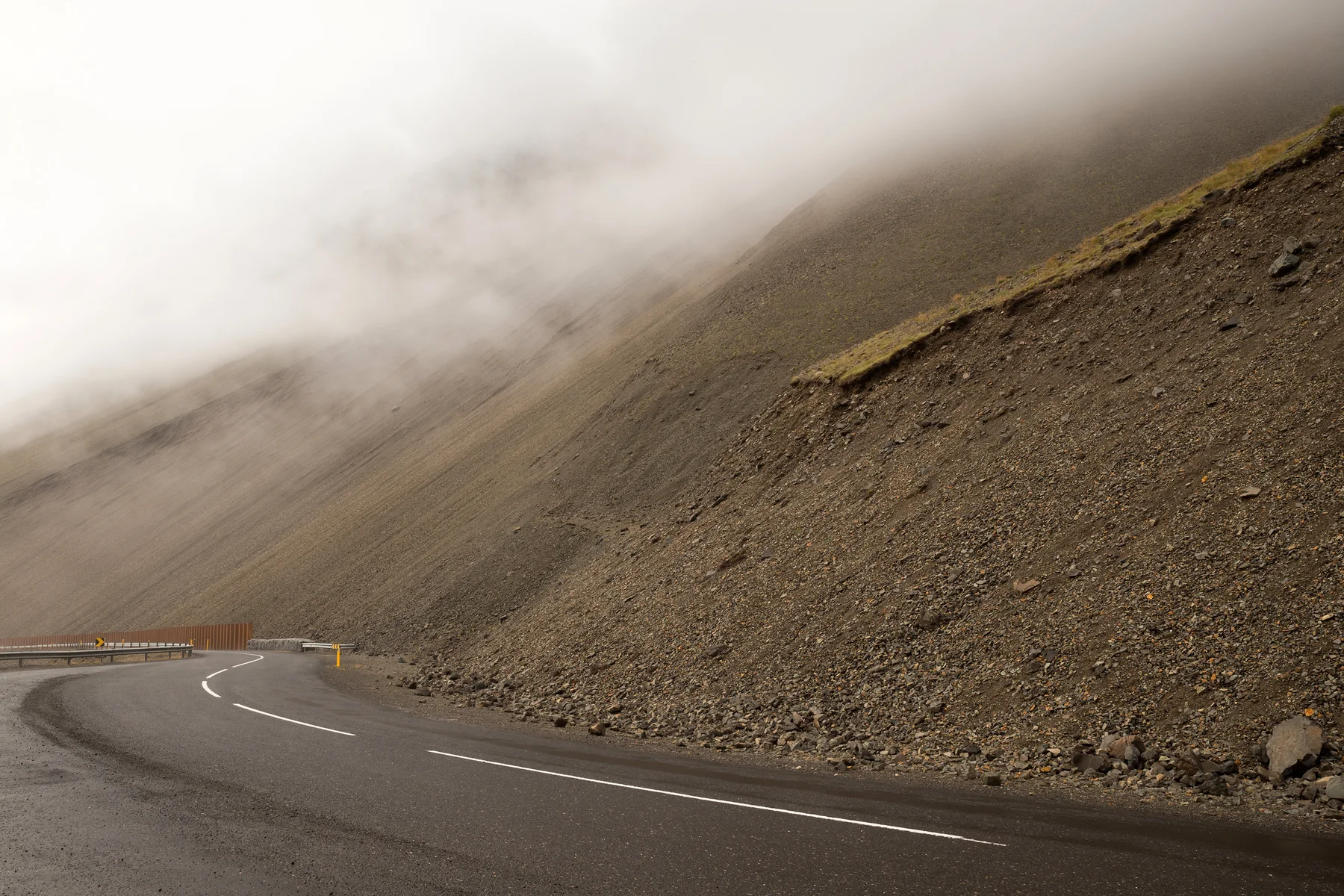
Do not stop at the map colour; read the notice for your segment
Colours invite a simple go-or-no-go answer, but the itinerary usually changes because of the text beside the segment and its update time. The notice may apply to one pass, a gravel stretch, a work zone or one direction. It may also turn an “after-lunch detour” into a stop you should not force.
I treat the road page as a cut list, not a sightseeing pass. If the main transfer needs another look, mark one or two sights, cafés or detours that can disappear today. That avoids the late-afternoon “we have already come this far” argument. How to split daily driving time shows how stops, fuel, check-in and activities fill the schedule; the road page tells you when to shorten it.
A road update has a timestamp for a reason
Umferdin states that road status is usually updated 07:00–22:00 from October to April and 08:00–16:00 from May to September; automatic measurements can also be wrong. The important point is the time boundary. An 08:30 screen reports what was available at 08:30; it cannot guarantee the condition of a mountain pass at 18:00.
This changes lodging judgment. When your next night is booked far away, a road change isn't just "missing one waterfall"; it can push late check-in, fuel, dinner, and tomorrow's fixed meeting closer together. If today was supposed to push from Vík toward the glacier lagoon but there's no stop or mid-way lodging to sacrifice, go back to Vík one or two nights and its segment logic. It cannot tell you whether the road is passable today, but it does show the practical benefit of moving the overnight base closer: a less pressured morning and less unnecessary backtracking. If warnings mention dust, low visibility, or strong wind, the South Coast dust page's three-part judgment catches the next question: continue, shorten, or stop.
Before Departure, at Lunch and Before the Pass: Check the Same Road Three Times
“Check road conditions daily” is too vague to guide a real day. Use three specific checks, each tied to a different risk.
| When to check | What to decide after checking | If the answer feels off, what to change first |
|---|---|---|
| Before leaving lodging | Can the main move segment still start in the planned direction; any closures, works, or warnings | Cancel the first optional stop, or make today a direct run to the next night |
| At lunch / fuel | Is the afternoon segment still worth keeping; has arrival time eaten the check-in buffer | |
| Before entering exposed segments, passes, or gravel branches | Do the last segment's data, weather, fuel, passenger state, and rental terms all hold simultaneously | Turn back, switch to main roads, stop at a safe service point, or stay overnight |
The third check is most often skipped because you're already in the car and feel "it's just a bit more." Yet this is exactly the moment least suited to sunk-cost decisions. If there's only one driver, someone in the car feels unwell, or wind/visibility is changing, the road data you see today isn't encouraging you to push the plan through; it's giving you a reason to stop earlier. Gravel road driving: following distance and stop lines breaks down surface handling and safety boundaries; Winter self-drive: morning judgments further splits road, daylight, lodging, and driver state; even if it's not winter, this sequence still applies.
A closed road is not a prompt to improvise a side road
Some mistakes come from treating information as a puzzle. When a road is closed, do not zoom out the map for a parallel-looking branch or ask whether 4WD should manage it. Road class, surface, wind, snow, rivers, rental terms and same-day management are separate questions. F-road and Highland access can depend on weather, snow, wet ground and conservation rules; 4WD does not turn Closed into open.
If you really want to include highlands in the trip, first read F-roads and 4WD: three safety gates, then verify with the day's official map. If your original plan was just considering a gravel alternative to save a little time, 2WD or 4WD is worth reading before picking up the car. None of these articles will open an "it should be fine" exception for you; their purpose is to avoid discovering at the roadside that vehicle type, insurance, and road requirements don't overlap at all.
Know when 1777 or SafeTravel is the better call
IRCA's traffic service, 1777, provides information on roads, weather, roadworks, and closures; the page lists its daily service hours as 06:30–22:00. Use it when you have already checked the map and notices but still need same-day travel guidance. It is not a substitute for planning the full day's itinerary. SafeTravel warns that Icelandic weather and road conditions can change quickly and provides Travel Conditions information and an app. Mobile data and downloaded navigation let you check again when it matters. This is why a self-drive eSIM should not be compared by data allowance alone: consider whether everyone in the car can access road conditions and navigation while retaining an emergency backup.
One small but practical step is to place the official road page, SafeTravel, your accommodation's phone number, and rental assistance in the same phone folder, then download an offline map of the next segment. You don't need to memorize everything before departure. You do need to avoid searching through ten browser tabs for a notice when the signal weakens or daylight fades.
Use road information to decide whether the day still works
Road information will not simply say “travel” or “do not travel.” It helps answer whether the main segment still works, how much of the afternoon can be cut, whether the hotel needs a late-arrival message and whether the next fixed activity justifies keeping that overnight stop. Those answers turn a vague worry into an adjustable plan.
With only three or four days, there is little room to absorb a change. Protect the experiences that matter and do not force Ring Road distances into a South Coast schedule. How to arrange three days in Iceland and How to keep lodging intact in rain apply the same principle: completing every sight is not the measure of a successful trip. Handling a change without ending in night driving is the more useful outcome.
Related Reading
Connecting data reading to today
Iceland daily driving hours: calculating navigation, stops, and check-in togetherIceland winter self-drive: deciding whether to move in the morningMore Reading
Connecting today to lodging and routes
Iceland accommodation nights: making each night work for tomorrowIceland rain itinerary: protecting rooms, meetings, and return drives firstQ&A | Questions worth settling before you leave
What is the difference between Umferdin and SafeTravel?
Umferdin is the road-status source for closures and conditions; SafeTravel adds safety and risk advice. Neither replaces a same-day notice from your rental company or activity provider.
When should I check the roads?
Check before you leave, check again if the wind or weather turns, and look once more before an exposed pass on a long day. A morning screenshot is not a plan for the afternoon.
Does “open” mean I can follow the original plan?
Not necessarily. Wind, visibility, the vehicle you hired, F-road terms and an activity’s meeting time can still make the original route a bad fit.
If I meet a closure, which stop should I cut first?
Drop the remote branch or the optional stop first. Keep a town, your accommodation and enough buffer to recover; trying to win the time back with night driving is not a sensible trade.
References
Roads, weather, roadworks, and service hours can all change; the following data was verified on August 24, 2026. Please re-check official pages and on-site signage on your actual departure day.
- IRCA/Umferdin | Definitions / About: Road status data sources, seasonal update windows, and automatic measurement data limits.
- Vegagerðin | Traffic service 1777: Traffic service role and opening hours for road, weather, roadworks, and closure notices.
- SafeTravel | Travel Conditions: ICE-SAR's safety information, rapidly changing road and weather alerts, and app information.
- Vegagerðin | Mountain roads: Official explanation of how highland road access is affected by spring and summer weather, snow, and wet surfaces.
- Unukorno/Wikimedia Commons | East Iceland Ring Road: Source for the article's real road-view image, CC BY 4.0; not a basis for same-day road status.
_2016.jpg)